


A towering ice cliff stretching as far as the eye could see confronted the early Antarctic explorers. They had come face to face with the world’s biggest iceberg: it was almost the size of France.
On 5th January 1841 a British admiralty team in the Erebus and the Terror, three-masted ships with specially strengthened wooden hulls, was picking its way through the pack ice of the Pacific approaches to Antarctica in an attempt to determine the position of the South Magnetic Pole. Four days later, they broke into open water and were hopeful that they might have a clear passage to their destination; but on 11th January the men were confronted by a gigantic wall of ice.
“Well, there’s no more chance of sailing through that than through the cliffs of Dover,” exclaimed Sir James Clark Ross, the expedition’s leader. Ross, who in 1831 had located the North Magnetic Pole, spent the next two years searching unsuccessfully for a sea passage to the South Pole; later his name was given to the ice shelf and the sea bordering it.
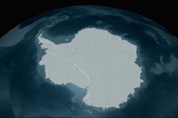
The Ross Ice Shelf has a surface area approximately the size of France and virtually fills a vast bay that slices deep into Antarctica. It extends east to west for about 500 miles (800km) between Edward VII Peninsula and Ross Island and inland for some 600 miles (970km). On the seaward side cliffs rise to a height of 200ft (60m) in places and the ice can be thick as 2450ft (750m) in the shelf’s gently undulating southern reaches, nearest to land.
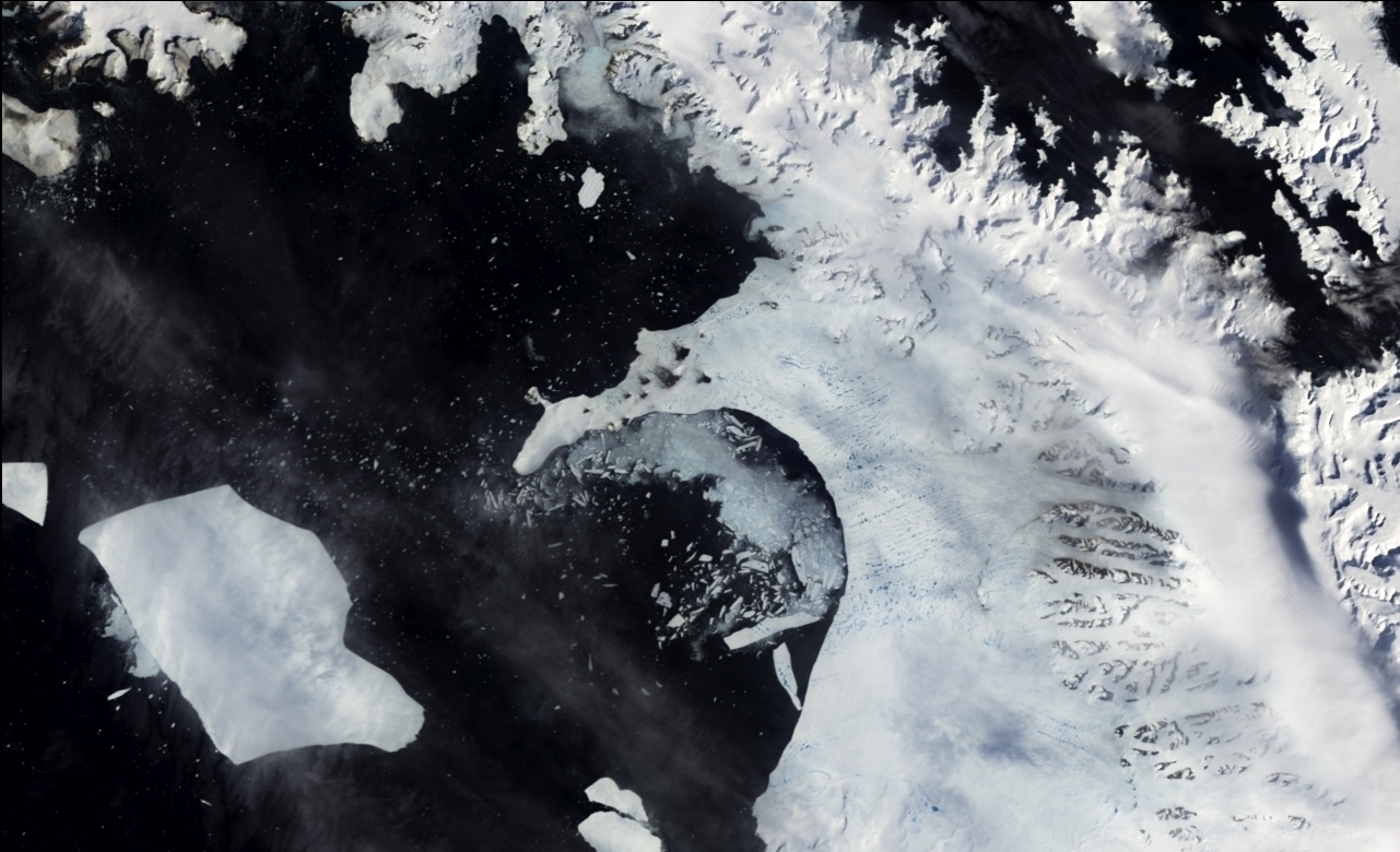
The shelf, which is rather like a huge, loosely moored raft, is constantly pushing out into the sea at a rate of between 5ft (1.5m) and 10ft (3m) a day. The Beardmore and several other massive glaciers flowing down from the distant Transantarctic Mountains exert pressure on the rear of the shelf and add to its bulk. At the same time, freezing of the sea underneath the ice shelf increases the thickness of the ice from below – by as much as 15-20in (38-51cm) some 200 miles (320km) from the coast. The fractures and crevasses that form at the inland edge of the shelf can run for many miles, often creating wide inlets of open water. When such an inlet encircles a mass of ice, gigantic bergs break free from the edge of the shelf; the largest known, which split off in 1956, had an area of some 12,000 sq. miles (31,000 km), slightly larger than Belgium.
The Ross Ice Shelf is always in flux. Glacial ice thrusting from behind adds to its huge size; snow is compacted into ice by the weight of further falls; and freezing seawater adds to the shelf’s depth from beneath. Unable to resist these pressures, the shelf pushes seaward. Icebergs break off the cliff edge and drift with the ocean currents, enabling scientists to study polar currents and the complex interaction between oceans and atmosphere. In a recent major calving, in 2000, a berg about the size of Jamaica broke off the shelf.
For centuries the Southern Polar Regions remained unseen and uncharted, although the ancient Greeks had concluded that there must be a huge continent in the Southern Hemisphere to balance the northern landmass of Eurasia. This belief was reflected in early European maps; even the great Flemish map maker Mercator (1512-94) showed an immense land around the South Pole which he called Terra Australis Incognita, despite the fact that, in 1578, Sir Francis Drake, driven far south by violent storms, saw no sign of the mythical continent.
Two hundred years later, Captain James Cook spent three years (1772-75) searching for Terra Australis, he found no trace of it, although he sailed beyond latitude 70° south. He was, nevertheless, convinced that there was “a Tract of Land near the pole, which is the source of all the ice spread over this vast Southern Ocean”. Early in the 19th century, the area came under increased scrutiny by British and American seal hunters. In 1820 a Royal Navy survey ship sighted the Antarctic Peninsula, and the first hunters landed the next year; later in the century, whalers superseded the sealers. Scientific curiosity as well as commercial interests prompted a flurry of exploration, but the ice-choked sea did not relax its guard on the land beyond.
Antarctica is packed with ice and snow to depths over 11,500ft (3500m). it is the world’s highest continent, with half its area standing more than 6500ft (2000m) above sea level, and with many active volcanoes. One of the largest is Mount Erebus on Ross Island. Antarctica is the driest place in the world – drier than the Sahara – and only some 2in (50mm) of snow falls inland, perhaps 20in (500mm) near the coast. It is also the Earth’s coldest place, temperatures can drop so low that boiling water tossed into the air immediately forms crystals of ice.
The emperor penguin Is the only animal to brave winter in Antarctica, breeding and raising its young here. The single egg is laid on the ice and is incubated by the male, which rests it on top of his feet, then settles a pouch of skin gently over it to keep it warm. Both parents feed the chick when it hatches.

Although the ice shelf presented an immense barrier to explorers, it eventually enabled them to reach the interior of this savage land, and more recently scientific research stations have been established on it. Scientists based here have discovered animal and plant fossils which reveal that Antarctica was once part of the ancient supercontinent of Gondwana, and they were the first to realize the existence of a hole in the ozone layer.


