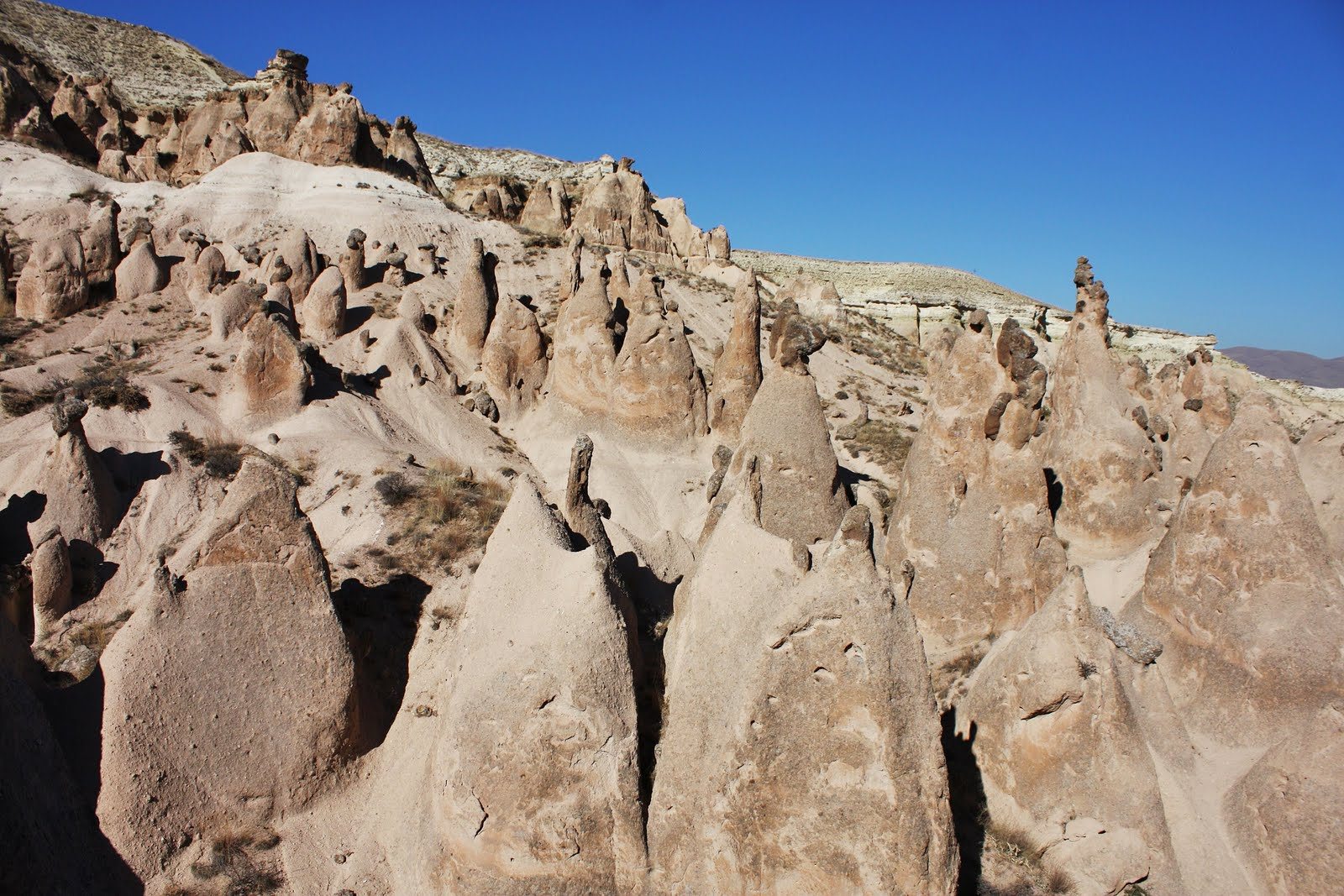
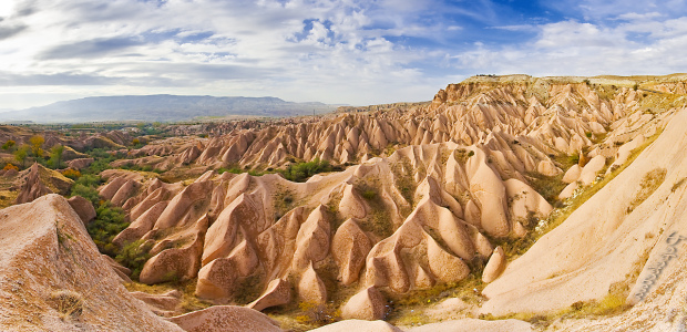
Needles of rock thrust upwards from the plain of Cappadocia, in central Turkey, to create a startling, almost unearthly landscape. The early Christians, who made their homes in this desolate terrain, adapted their living conditions to the environment in the most extraordinary ways.
In the uplands of Turkey’s Anatolian heartland lies the ancient region of Cappadocia. Riven with valleys and dotted with extinct volcanoes, the Cappadocian plateau was once a major trading crossroads, traversed by merchant caravans and warring armies alike. South of the city of Kayseri, capital of the province of the same name, is a broad territory of strange, haunting landscapes dominated by rock cones sculpted by driving wind.
The process that shaped this unique landscape began when the volcanoes of Cappadocia erupted about eight million years ago. They deposited countless layers of ash, lava and debris, raising the altitude of the land by more than 1000ft (300m) to form a prominent plateau. Millions of years of compression turned the volcanic ash into a soft, pale rock called tuff. This was overlaid by a thinner layer of dark, hardened lava known as basalt. As the basalt cooled, it contracted and split, laying itself open to the erosive action of the weather. Streams and floods criss-crossed the plateau, cutting ever deeper, and earthquake shocks and winter frosts helped break up the layers of tuff and basalt.

Today, the process of erosion continues, slowly wearing down the pinnacled landscape and exposing the multi-coloured layers of earth. These range from the palest tuff, through tones of ochre, russet and deep chestnut (caused by mineral impurities), to the black of the basalt.
The desolate appearance of the terrain belies the fertility of a soil rich in mineral nutrients. If carefully irrigated, the valleys can produce abundant crops of fruit, cereals and vegetables. A closer look at this extraordinary landscape reveals the most unusual signs of human habitation, for the soft tuff has been carved and tunneled to create womb-like spaces where people lived and worshipped long ago. The greatest concentration of these rock dwellings is 56 miles (90km) south-west of Kayseri.
The most famous inhabitants of the cliffs and cones of Cappadocia were the early Christians. Christianity was brought to Anatolia by St Paul in the first century AD. In the fourth century AD – the early years of the Byzantine Empire – a native Cappadocian, Basil the Great, was made Bishop of Caesarea (now Kayseri). He encouraged new monastic settlements in the valleys of Cappadocia and for the next thousand years the monks carved away at the tuff, creating numerous churches and hermitages.

These masons imitated the free-standing architecture of the Byzantine era. Early churches were based on the simplest plan, with barrel-vaulting, a rectangular nave and a small apse, the whole no more than 26ft (8m) long. Larger churches were built in the 10th and 11th centuries on the Byzantine cross model, with central and side domes. They were all decorated in Byzantine style, and their murals depicting the life of Christ and the saints have survived to the present day, thanks to the darkness and dryness of the church interiors.
In the eighth century, the Iconoclasts, a Christian sect which forbade the worship of icons, destroyed many of the early frescoes and replaced them with geometric patterns, but by the tenth century, there was a return to rich and colourful representations. Patrons vied each other to hire the best mural artists and some of the most magnificent paintings from this period can be seen in the churches of the Goreme and Urgup valleys. The Turkish invasions of the 13th century dealt the death blow to church building.
Curious looking rock cones rise from the plain near Urgup. The pinnacles grow higher as the valley floor at their base is worn away by water and frost. They are then whittled down by the wind until, finally, they collapse.

A few miles north-east of Goreme is the monastery complex of Zelve, noted for its churches carved into the cliffs and its capped pinnacles known as fairy chimneys. These are tall pillars of soft rock that are partly protected from erosion by the black conical boulders of weather-resistant basalt resting on top of them.

To the south of the city of Nevsehir are a number of underground towns, such as Derinkuyu, carved on many levels out of the tuff. The inhabitants of these warren-like excavations were known as troglodytes, and each complex could house several thousand people hiding from enemy soldiers. Early Christians used these underground refuges, but their last occupants were Turks escaping from Egyptian troops in the 19th century.
There were many underground cities in Cappadocia, some connected by tunnels several miles long. They had storerooms, living quarters, wells, air shafts, pits to catch invaders and a maze of interconnecting passages. With doorways sealed by large boulders, they made impregnable, if dark and uncomfortable, underground fortresses.

The Cappadocia settlements were extremely advanced. Shafts provided entrance to the city, and were used for ventilation, while water came through a shaft sunk down to the water table. Streets connected one area with another; wheel doors blocked ‘no entry’ zones. Rooms were cut into the tuff, with major furnishings such as beds also hewn from the solid rock. Niches provided storage space and housings for oil lamps.
Carved-out churches and underground cities add a human dimension to Cappadocia, but essentially it is a vast landscape of extraordinary rock shapes, created over millions of years, that takes the observer’s breath away.
-end-


